
Five boroughs and New Jersey
Aerial imagery covers about 2,500 square kilometres, extending from New York’s five boroughs to Jersey City and Newark.
New York City, New York, USA Map
X-Plane 11
Trace the Hudson past Manhattan, cross to the outer boroughs or land at one of the city’s waterfront heliports.
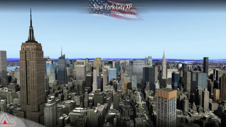
Aerial imagery covers about 2,500 square kilometres, extending from New York’s five boroughs to Jersey City and Newark.
More than 6,300 custom buildings recreate neighbourhoods on both sides of the Hudson.
Four heliports have detailed models. The city scenery is compatible with New York Airports XP.


Designed for X-Plane 11.
Remove earlier or overlapping scenery for the same location before installing. On Windows, run the supplied installer. On macOS or Linux, follow the manual installation guide included with the download.
Customer support has ended for this edition. No further updates will be released.
New York’s five boroughs meet around a tidal harbour. Manhattan lies between the Hudson and East rivers, with the Bronx to the north, Brooklyn and Queens on Long Island, and Staten Island across the Upper Bay. On the New Jersey shore, Jersey City faces Lower Manhattan and Newark lies farther west beyond the port approaches.
Two clusters of tall buildings give Manhattan its familiar profile. Lower Manhattan grew around the harbour and the early trading city. Midtown developed farther north around major railway terminals, avenues and commercial districts. Between them are lower neighbourhoods where the piers, bridges and street grid are more prominent from the air than the skyline.
The water remains a working part of the city. Ferries cross the harbour and the Hudson, ships pass the Statue of Liberty and the Narrows, and waterfront heliports put aircraft close to the business districts. Seen from a low-altitude flight, the crossings are as important as the towers. They connect places that look close together on the map but are separated by broad stretches of water.


