
Three Chicago airports
O’Hare (KORD), Midway (KMDW) and Chicago Executive (KPWK) each have a separate airfield layout.
Chicago, Illinois, USA Map
X-Plane 11
Fly from the airline hubs at O’Hare and Midway to the business aviation ramps at Chicago Executive.
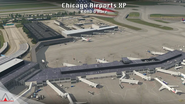
O’Hare (KORD), Midway (KMDW) and Chicago Executive (KPWK) each have a separate airfield layout.
The terminals and selected hangars have modelled interiors visible from the ramp.
SAM provides animated jetways, docking guidance and marshallers. Dynamic lighting illuminates parked aircraft and people on the apron.


Designed for X-Plane 11.
Remove earlier or overlapping scenery for the same location before installing. On Windows, run the supplied installer. On macOS or Linux, follow the manual installation guide included with the download.
Customer support has ended for this edition. No further updates will be released.
Chicago’s three airports grew out of very different parts of the metropolitan area. O’Hare occupies a broad tract northwest of the city, Midway fits into the street grid on the southwest side, and Chicago Executive serves the northern suburbs near Wheeling and Prospect Heights. The distances between them are modest, but the change in scale is apparent from the first sight of the ramps.
O’Hare began as the airfield for a Douglas aircraft factory during the Second World War. Its earlier name, Orchard Field, survives in the identifier ORD. Scheduled airline service began in 1955, and airlines moved much of their traffic there as jets outgrew Midway. At Midway, houses and streets come right up to the airport boundary. Diagonal runways make the most of a site covering roughly one square mile.
Chicago Executive grew from the much smaller Palwaukee airfield. Its name recalled two roads, Palatine Road and Milwaukee Avenue. Business aircraft, flight schools and private owners give its hangars and aprons a different rhythm from the terminal gates at the two airline airports.
Included airfields · KORD, KMDW, KPWK


